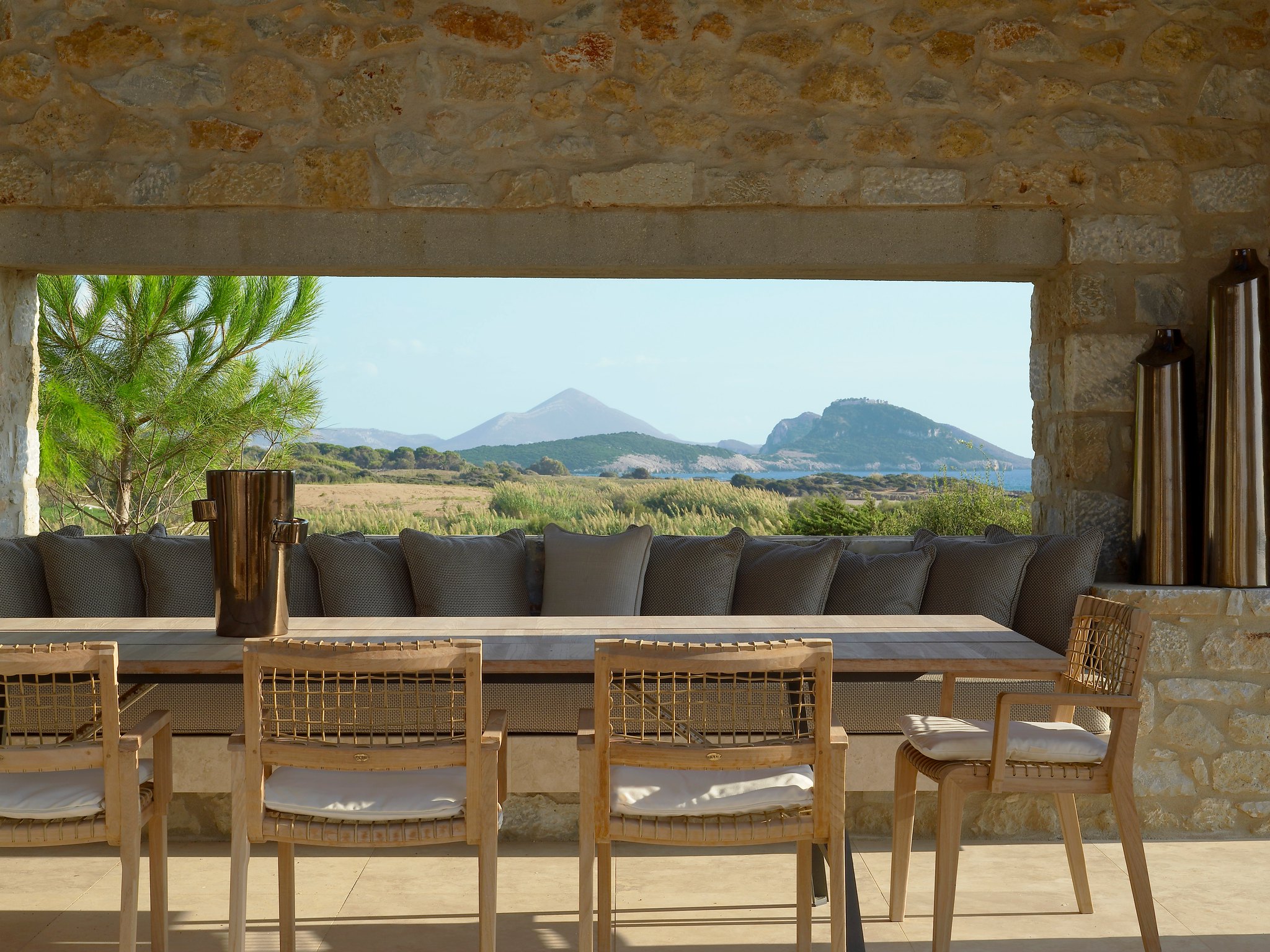
Successful landscape design begins with an in-depth analysis of the current conditions of a property. This beginning property analysis allows the designer to identify the constraints of the site while also addressing a client’s design wish-list.
Typically, landscape designs begin “Plat of Survey’s” prepared by a licensed surveyor. This survey acts as a base layer where a landscape designer would be able to prepare a new design utilizing the existing site conditions.
Using an official survey allows for extreme accuracy in the design. Having an official survey prepared is an expensive service which not all homeowners have access to, especially new homebuyers.
With the vast improvement and availability of free satellite and property information landscape designers can utilize these tools throughout the design process.
Satellite imagery provides remarkable detail and provides important context of where the design site is situated. In addition, satellite imagery websites can help obtain property dimensions, calculate average square-footage costs, measure surrounding building heights and even identify existing tree species. These tools can also be used to help provide a client with an initial quote for design services.
The following resources have become reliable tools for landscape designers and can be utilized throughout the design process to better provide for clients.
Online Courses for Landscape Design
Google Earth
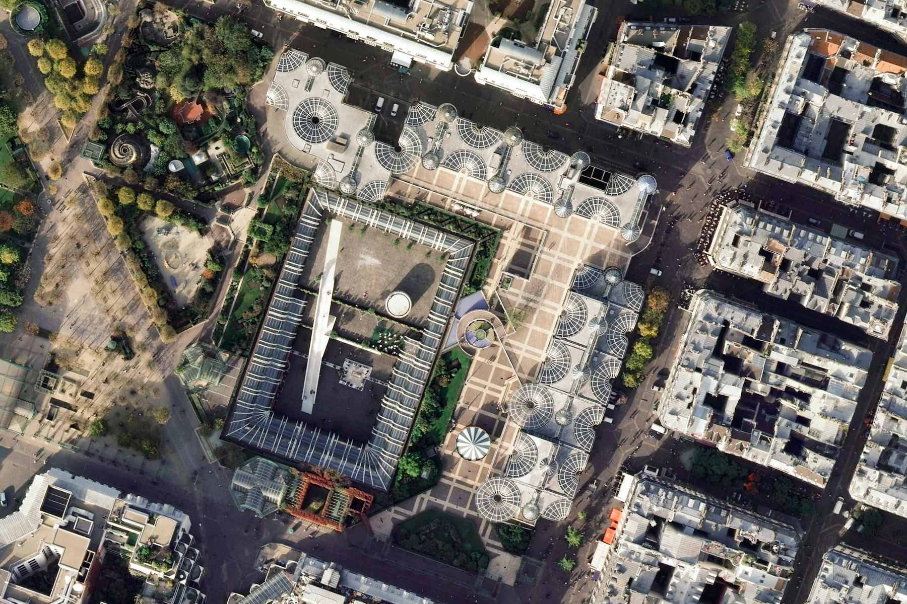
Google Earth is a free browser-based software that many landscape designers use as a starting point when approached with a new project.
The benefit to Google Earth is that this software allows you to pin-point your design location with accuracy and view not only the design site but also the surrounding areas with varying levels of zoomed in detail.
Surrounding context can be viewed with as much detail as the design site, allowing designers to understand how the design will be situated in the community.
Using the provided “Measuring Tool,” you are able to determine dimensions of the property quickly. This tool also works seamlessly for measuring areas that would be difficult to do so at a site level such as measuring curves, pool widths, pond size and wooded lot coverage.
Google Earth also provides a moveable timeline bar that shows the date when the satellite imagery was captured. This feature also allows you to see past satellite imagery data. This can be used to see how a site has changed over time but is also a useful tool to observe how a site looks in different seasons. The Google Earth timeline is also a powerful feature for creating portfolio pieces, showing the before and after the implementation of a landscape design.
As you zoom in and out on Google Earth’s satellite imagery there will be a changing scale bar at the bottom right of your screen. The area currently being shown on Google Earth can be exported using the shortcut “Ctrl + P”, creating a pdf of the satellite image.
This PDF image includes Google Earth’s scale bar that will allow for the image to be scaled when imported into an architectural drafting program such as AutoCAD, Rhino or Vectorworks. Using Google Earth landscape designers are able to create accurate base plans, allowing them to streamline the design process. Having an accurate base plan of ones property is also a useful resource for homeowners.
Google Earth updates their satellite imagery on average once per year while also providing 3D renderings for each area. If higher detail is required for your specific design location software alternatives such as NearMap are available. NearMap updates their imagery up to 6 times a year and at a resolution of 7cm per pixel, which is nearly double the resolution of Google Earth.
Top Books for Landscape Design
-

Architectural Gardens: Inside the Landscapes of Lucas & Lucas
$ 50.00 Learn More -

Bernard Trainor: Ground Studio Landscapes
$ 55.00 Learn More -

The Tree Book: Superior Selections for Landscapes, Streetscapes, and Gardens
$ 79.95 Learn More -

The Landscape Imagination: Collected Essays of James Corner 1990-2010
$ 60.00 Learn More -

The Architecture of Trees
$ 130.00 Learn More
CAD Mapper
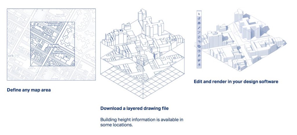
CAD Mapper is a powerful browser-based software that takes publicly accessible mapping information and transforms it into workable data sets for popular design softwares such as AutoCad, Sketch-Up, Rhino and Adobe Illustrator.
CAD Mapper is a free software when used for areas up to 1 km2 or 250 Acres. Providing landscape designers with workable data sets expedites the design process and also improves the quality of any required deliverables. CAD Mapper data can be used to prepare high level permit drawings as well as concept design developments.
When a design site has been located, CAD Mapper provides 3 possible data export options. The first data set is a 3-D Axonometric. An axonometric view is a great graphic diagram to highlight large surrounding built forms and to create shade diagrams for your design site. This file can also be used as a starting point when creating your own 3-D model.
Understanding how surrounding buildings impact shade patterns on your site is critical for good plant selection as well as feature placement.
A 2-D plan view and a topographic map can also be generated using CAD Mapper. Plan views that incorporate topographic data are instrumental when designing features such as retaining walls, staircases, garden walls, pool depths and even tree placement.
Topographic data allow landscape designers to gain a sense of space even without stepping foot on site. This data focuses on the elevation and slope of specific locations and landscape designers have been trained to interpret this information. Understanding drainage requirements and surrounding area elevations dictate not only the potential cost of projects but also critical design decisions.
CAD Mapper is a powerful tool that provides landscape designers with the required resources and information to begin design interpretation. If a presentation or graphic map is required Mapbox is considered by most to be the Photoshop of mapmaking (Mapbox, 2020). Using live map data, designers have full control over included elements including topography color, building color, highlighting select map areas and the ability to text overlay.

GIS Resources
Geographic Information System more commonly referred to as GIS is a tool to visualize integrated data sets for a wide variety of topics (ESRI 2019).
GIS information has widespread availability and has the ability to provide an abundance of property information that is critical for landscape designers to produce effect designs (Nijhuis, 2016).
Property lines, public right of way locations, setback requirements, wetland boundaries, zoning information and even street tree species can be found through publicly accessible GIS information. This information is accessible using municipalities and counties GIS mapping portals and can be typically found categorized under Open Data, Mapping or Engineering Standards within these municipal websites.
GIS mapping available through public access typically allows you to customize the map being viewed to ensure only the data you require is being captured. GIS mapping often shows an abundance of information and it is a matter of filtering and turning-off the unrelated data sets.
Using these customization tabs, the map can be curated to your specific design site while also providing you with critical information needed to ensure your design is constructable.
In addition to your local municipalities GIS portal, additional GIS information is accessible through conservation authorities. This data is typically fauna-flora centric as well as highlighting floodplain and key drainage areas. This is especially useful information when designing properties over 1 acre in size.
OpenStreetMap and Esri Open Data Hub are two free online GIS data hubs that offer highly detailed data sets. These programs consist of thousands of data sets and require customization in order to cater the map for your design location and needs. GIS mapping offers an abundance of information that allows landscape designers to properly tailor their design to the clients site.
Satellite imagery continues to improve and has become a fundamental tool for those requiring a landscape design. While Satellite imagery has improved in both clarity and accuracy professional surveys continue to be the only form of mapping that should be relied on for any construction documents.